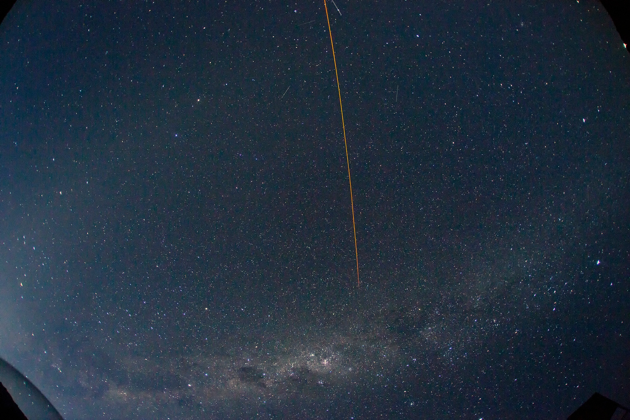
A single 10sec exposure form the Cerro Pachon All-Sky Camera obtained on the first night of operation, January 13, 2014. The field of view spans 147.5 x 94.3 degrees and slightly more than 180 degrees in the corners where the local horizon is visible. The orange streak is the Sodium laser being used for Gemini South adaptive optics.
Introduction and Scope
The Large Synoptic Survey Telescope (LSST) is a wide-field 8m telescope that will survey the southern sky over a period of 10 years. Each LSST observation (a visit) has a duration of 34 seconds consisting of 2 back-to-back 15-second exposures re-pointing to the next sky position. The LSST will implement a "scheduler" that will optimize the observing cadence against science priorities and local observing conditions. To this end the LSST project has developed an operations simulator (OpSIm) that models the temporal sequencing of visits given parameters of science proposals, constraints of hardware performance and historically based observing conditions (seeing, sky brightness and weather).
The current inputs used in the LSST OpSim for the site characteristics, seeing and weather, are based on measured data from the LSST site on Cerro Pachon and CTIO. The OpSim seeing model was based on DIMM measurements made on the LSST site from 1998 - 2006. The DIMM data were scaled for an outerscale of 30m and an 8.4m aperture following Tokovinnin et al. (199?) to form a prediction of the expected atmospheric delivered image quality that would be seen by LSST.
(add short description of current sky brightness model)
At the time of the initial OpSim development there were not sufficient data from the LSST site to develop a weather model (cloud coverage vs time). Instead we developed a weather the OpSim weather model from CTIO night logs taken from 1975 - 2005. These night logs recorded the observations of the on-site telescope operator and their assessment of net cloud cover on a scale of 0 (no clouds) to 8 (completely opaque) every 3 hours (typically 4 times per night). These logs contain no information about the spatial structure of the observed clouds and are by their nature qualitative. The current OpSim treats the cloud cover as uniform over the whole sky and derived extinction from scaling the cloud cover fraction.
The current input models for the sky brightness, transparency and cloud cover lack the spatial and temporal resolution needed for detailed algorithm optimization for the LSST scheduler. This project aims to obtained high fidelity multi-color data over most of the visible Cerro Pachon sky from which we can develop a high fidelity models that can be used for scheduler optimization. Alternately the empirical data can be used as direct input to the optimization effort.
Instrument and Experimental Design
This will be where Chris Stubbs uploads the information regarding the newly installed Cerro Pachon all sky camera.
Initial Results
Sky brightness in B,V,R vs. time, for night where moon set at the end of the night

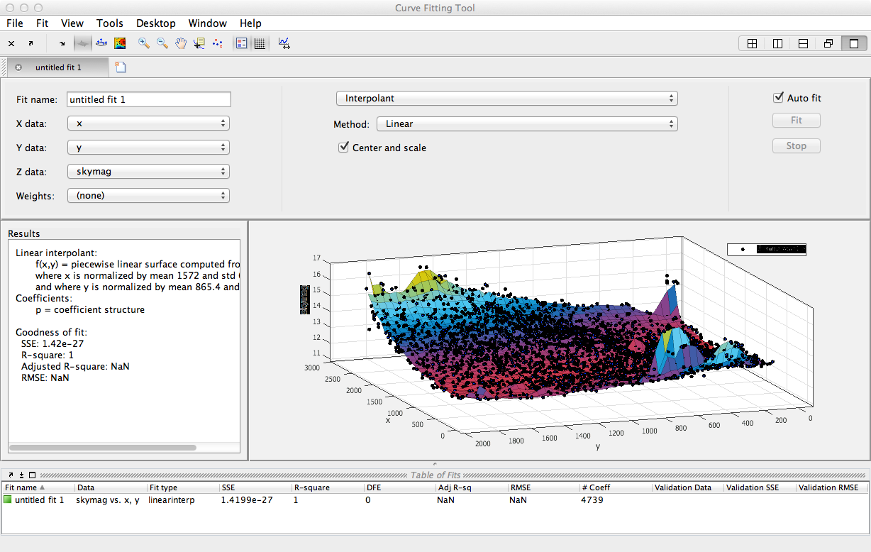
surface plot of sky brightness across the image:
Color calibration using the sun